Bruck - Klausegg - Bruck

Overview

Walking time
00:45 h
Route Length
2.5 km
altitude meters uphill
100 hm
altitude meters downhill
100 hm
highest point
620 m
Route Start

Community hall Bruck (Gemeindehaus), Dorf 40a, 6260 Bruck am Ziller

Route End

Community hall Bruck (Gemeindehaus), Dorf 40a, 6260 Bruck am Ziller

Altitude Profile

Weather

Description

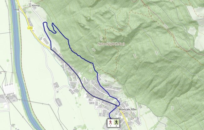
Starting from the Municipal office climb gently to the Dorfstrasse – cross this and then turn left heading gently uphill. Just past the last houses the trail continues along a footpath towards Klausegg. At the end of the footpath take a forest trail. Follow this to the Dorfstraße and then return to Bruck.

Der Inhalt kann nicht angezeigt werden.
Bitte akzeptieren Sie die Cookies, um den Inhalt zu laden.