

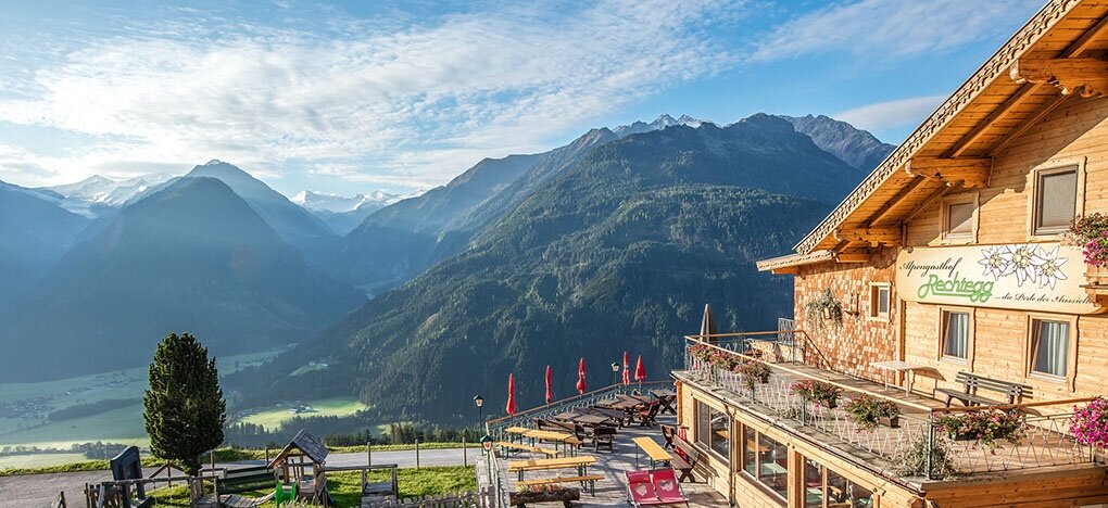
On the third day you cover 20 kilometres and the trail takes you up to 2,444 metres above sealevel. The highest point of the hike is the rocky double peak of the Kröndlhorn mountain, which stands out against the otherwise gentle green pastured mountains of the Kitzbühel Alps. There is a small memorial chapel rather than a summit cross at the highest point, and hikers enjoy stunning views of more than 70 three-thousand-metre peaks. The stage finishes at the Alpengasthof Rechtegg inn at 1,278 metres altitude above the National Park village of Neukirchen am Großvenediger.
If weather conditions, such as snow at high altitudes during low season, or level of fitness do not permit stage 2 of the Hohe Tauern Panorama Trail, then we recommend the following alternative route:
Alternative route 03 Sonnenweg | Königsleiten-GH Rechtegg/Neukirchen.