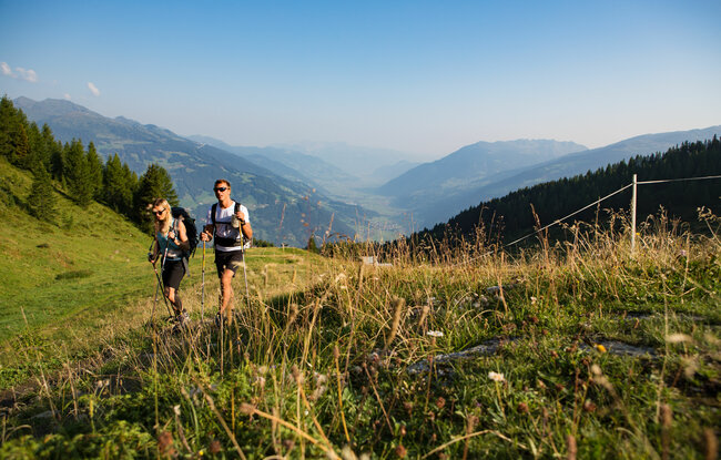
Select Filter
Filter
Activity
Hiking
Hiking & mountain tour
Pilgrimage trail
Themed walks
Cycling and mountain biking
Cycling tour
Mountainbike tour
Road bike tour
Singletrail
Bike & Hike
Nordic walking
Trailrunning
Running tracks
Swimming
Fun sport
Via ferrata
e-Bike & Climb
Attraction
Skiresort
Lifts
Slopes
Snow park
Ski-nordic-classic
Ski-nordic-skating
Winter walking
Tobogganing
Bed and breakfast
Apartment
Campsite
Mountain hut
Lifestyle & sports fashion
Station
Parking spot
Cable car
Webcam
Public toilet
Family friendly routes
Buggy friendly routes
Playground
Zillertal Cable Cars
Discount partners
Family friendly bike routes
swimming pools
Summit Hikes
Summit tour
highest point
572 m
Route Length
1 km
altitude meters uphill
4 hm
Status Closed
Starting Point
Isskogelbahn Bergstation
End Point
Wiesenweg
highest point
1892 m
Route Length
6.8 km
altitude meters downhill
640 hm
Status Closed
Starting Point
Wald - Ortsmitte
End Point
Schnitzerei Kammerlander
highest point
923 m
Walking time
00:36 h
Route Length
1.92 km
altitude meters uphill
55 hm
Starting Point
Gasthof Kühle Rast
End Point
Schwarzachalm
highest point
1362 m
Route Length
17.5 km
altitude meters uphill
329 hm
altitude meters downhill
329 hm
Difficulty
Middle
Starting Point
Gasthof Finkau
End Point
Zittauer Hütte
highest point
2330 m
Walking time
03:00 h
Route Length
6.82 km
altitude meters uphill
910 hm
Difficulty
Middle
Starting Point
Königsleiten
End Point
Filzstein
highest point
1699 m
Walking time
01:30 h
Route Length
5.19 km
altitude meters uphill
191 hm
Difficulty
Middle
Starting Point
Kneippbrunnen am Tourismusbüro
End Point
Kneippbrunnen am Tourismusbüro
highest point
1169 m
Walking time
01:30 h
Route Length
4.68 km
altitude meters uphill
178 hm
Your newsletter

Sign up for our newsletter and receive the best tips about the Zillertal Arena, the latest offers, events and much more every month.

Der Inhalt kann nicht angezeigt werden.
Bitte akzeptieren Sie die Cookies, um den Inhalt zu laden.